Chinese Navigation
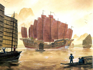
They use water compass for keeping time. During the time of Zheng He and the treasure Fleet, the average the ship could travel about 20 miles per watch. For more speed they throw objects over the bow of the ship. They used a type of tool called qianxinban, it was a board consisting of twelve pieces of squared wood. They also used a tool called liangtianchi, a vertical ruler. Captains used sailing charts that were in section depending where the ship was. It shows land marks so the captains can recognized their location.
Compass and The Compass Rose
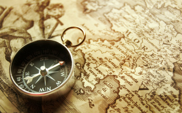
Back then navigators use a type or rock called a lodestones (magnetic rock) suspended by a string, others were the same rock but floating on a piece of wood, and a magnetized needles which floated on a straw and pointed north. But during 1274 a group of people made a compass with a magnetized needle supporting the compass card showing 4 or 8 points direction, and it was the Venetians. Romans named a grid for their maps to measure distance east and west, north and south. They measure longitude east-west and latitude north-south.
Polynesian Navigation
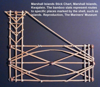
Polynesian use the sun, stars, sea swell patterns, cloud formation, and sea marks such as birds flight habits. They also used flotsam were if they sea palm fronds, coconuts or any kind of vegetation also signaled nearby land. They memorized they stars compass. They will named the island the center point, so they can go around.
